This option is useful for instant appraisal of how site levels fall from one side to another.
On the main toolbar, click the ![]() survey surface shading button when the main plan view is active.
survey surface shading button when the main plan view is active.
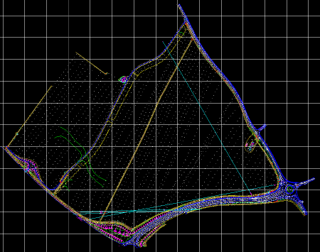
The following pictures show the effect. The first picture shows the survey in plan as loaded from file. The second picture shows the effect of turning on the height shading.
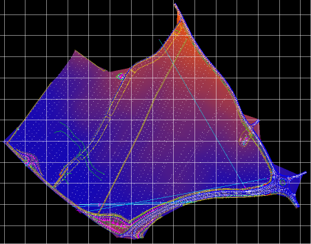
Higher areas are shown in the brighter orangey shades and lower areas are shown in the darker bluey shades.
You can toggle the height shading on/off by clicking the ![]() survey surface shading button.
survey surface shading button.